Blog
Thoughts on geospatial data science, open-source software, and teaching.
Subscribe
Posts
2026
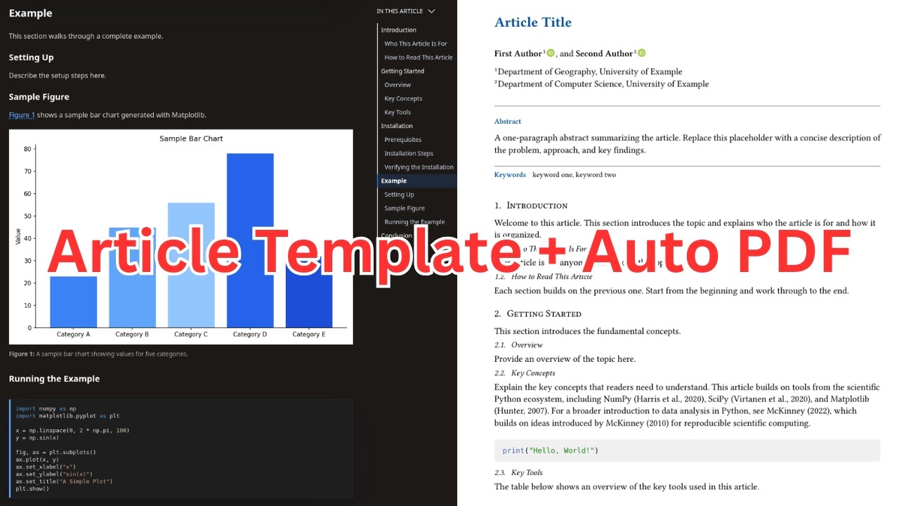
April 15, 2026 – A step-by-step tutorial on writing journal articles in MyST Markdown with automatic PDF generation and website deployment using a GitHub template.
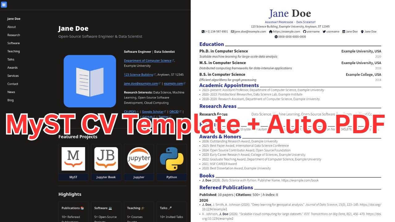
April 10, 2026 – A step-by-step tutorial on building a personal CV website with MyST Markdown and Typst that automatically generates a PDF version of your CV.
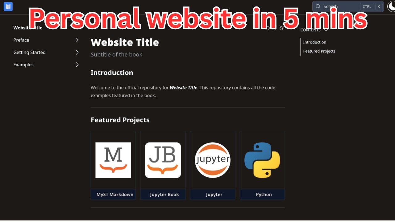
April 9, 2026 – A step-by-step video tutorial showing how to create and deploy a personal website using the MyST Markdown template and GitHub Pages.
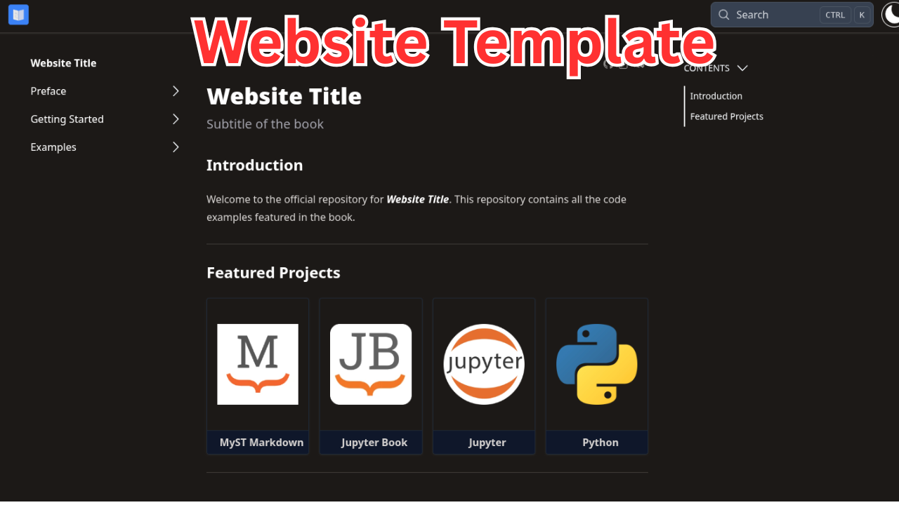
April 6, 2026 – A GitHub template that bundles MyST Markdown, GitHub Pages deployment, Netlify PR previews, and pre-commit hooks into a ready-to-use starting point.
April 6, 2026 – How I rebuilt gishub.org using MyST Markdown for the website and Typst for automatic CV generation from the same Markdown source files.
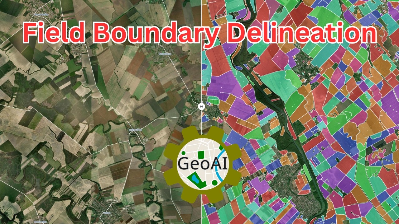
March 20, 2026 – A complete tutorial on using instance segmentation and the Fields of the World dataset to delineate agricultural field boundaries with GeoAI.
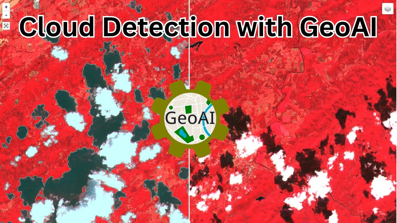
March 19, 2026 – Detect clouds and cloud shadows from any satellite imagery using OmniCloudMask and GeoAI, with post-processing, vectorization, and cloud-free mask generation.
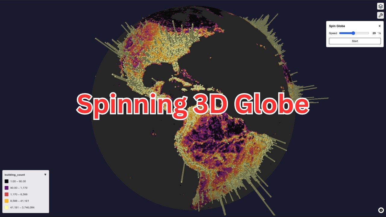
March 6, 2026 – A step-by-step tutorial on creating an interactive spinning 3D globe with raster and vector data overlays using a web-based tool or Jupyter Notebook, no coding required.
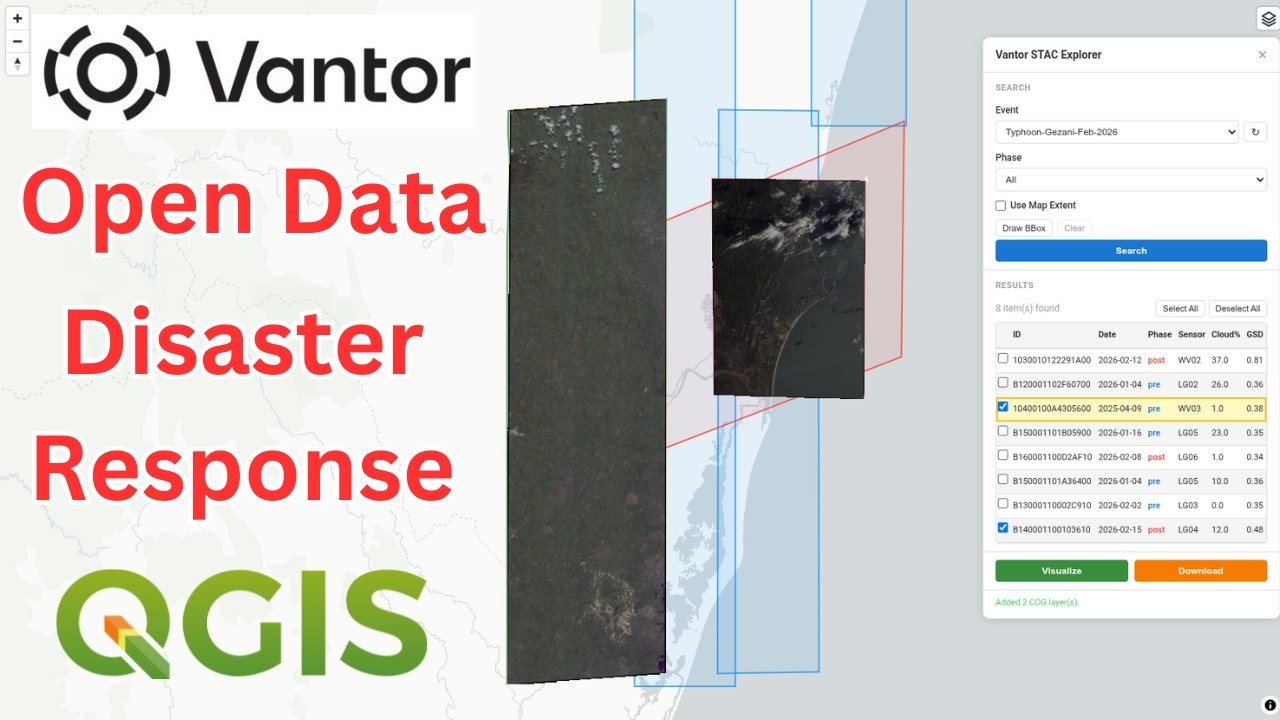
March 3, 2026 – A tutorial on accessing, visualizing, and downloading free satellite imagery from the Vantor Open Data Program using a web app or QGIS plugin.
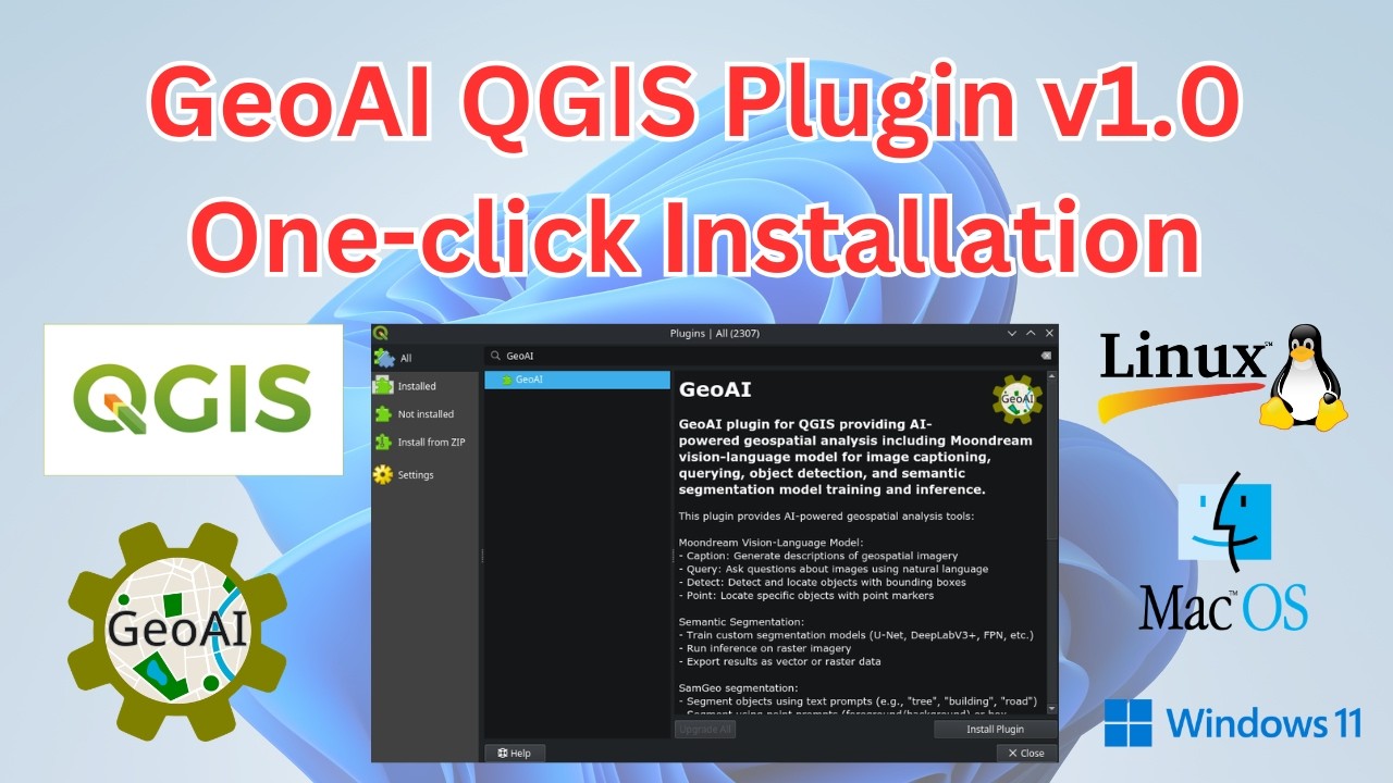
February 25, 2026 – Announcing GeoAI QGIS Plugin v1.0 with one-click installation, SAM 3, water segmentation, forest segmentation, and export to vector, raster, COCO, YOLO, and Pascal VOC formats.
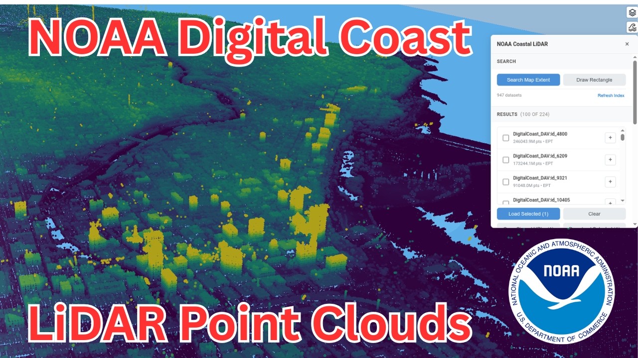
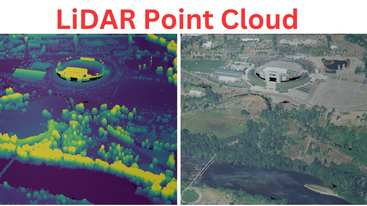
February 18, 2026 – A step-by-step tutorial on searching, loading, and visualizing massive NOAA coastal LiDAR point clouds directly in your browser without downloading any data.
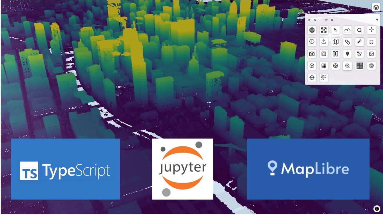
February 13, 2026 – Introducing anymap-ts, a new Python package built on MapLibre and TypeScript for interactive geospatial visualization in both web apps and Jupyter Notebooks.
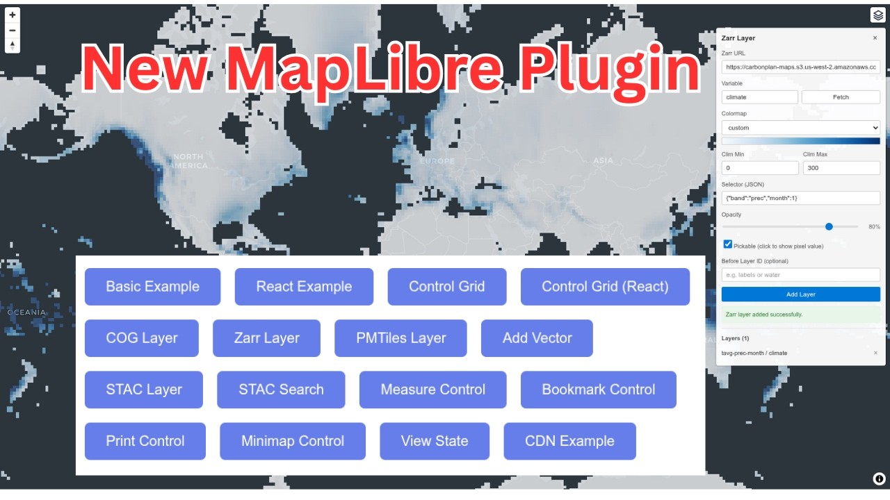
February 10, 2026 – Introducing maplibre-gl-components, a MapLibre plugin for visualizing cloud-native geospatial formats like COG, Zarr, PMTiles, FlatGeobuf, and GeoParquet with built-in UI components.
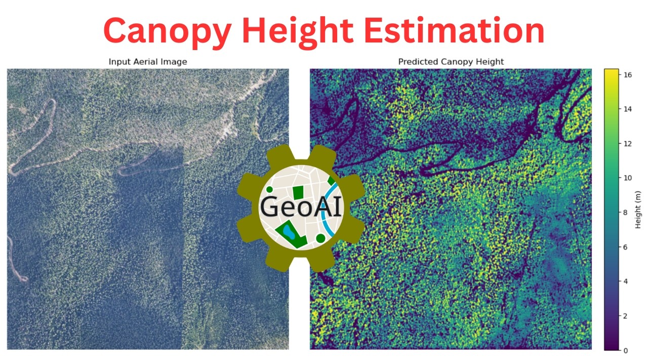
February 6, 2026 – A step-by-step tutorial on estimating canopy height from aerial and satellite imagery using Meta’s pretrained deep learning model with the GeoAI Python package.
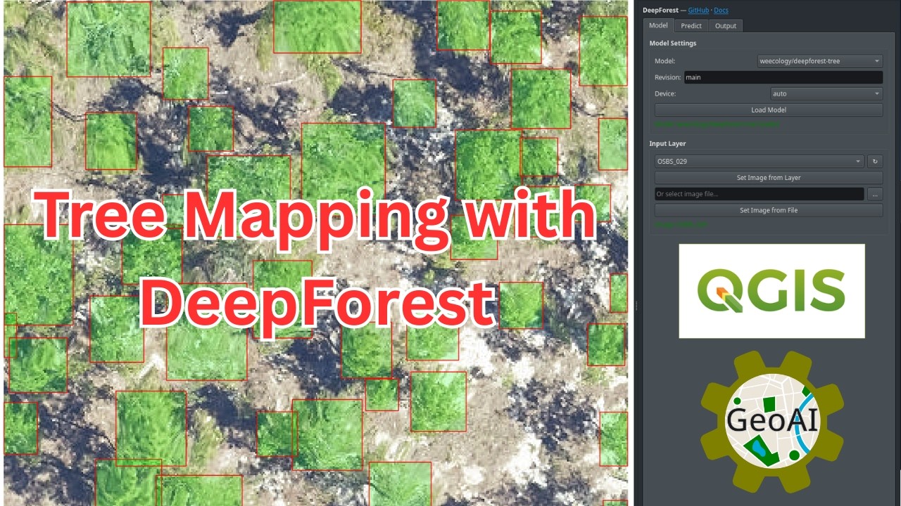
February 3, 2026 – A step-by-step tutorial on detecting and segmenting tree crowns from satellite imagery using the QGIS GeoAI plugin with DeepForest pre-trained models, no coding required.
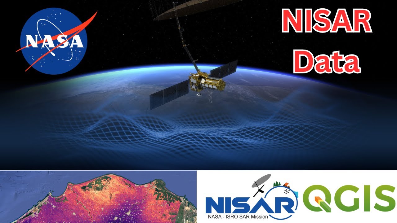
January 28, 2026 – A step-by-step tutorial on downloading and visualizing NASA-ISRO NISAR SAR satellite data in QGIS using the NASA Earthdata plugin, covering search, download, format conversion, and visualization.
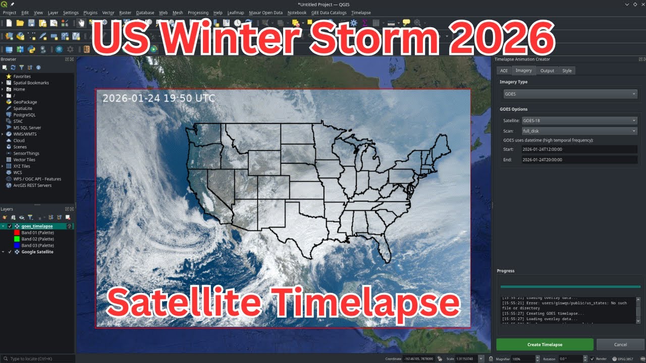
January 24, 2026 – Create a stunning satellite timelapse of the 2026 US winter storm using NOAA GOES-18 imagery and the QGIS Timelapse Plugin, no coding required.
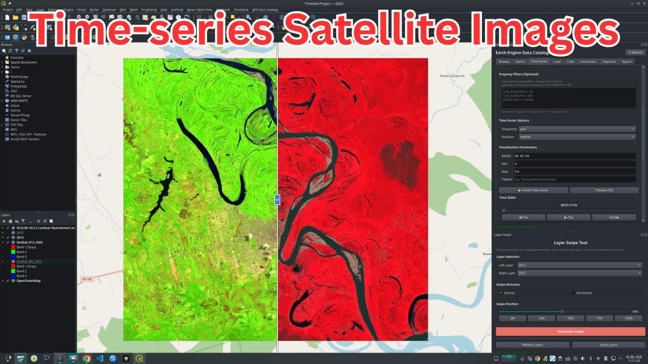
January 21, 2026 – A step-by-step tutorial on creating and downloading time-series satellite imagery using the GEE Data Catalogs Plugin v0.5 for QGIS, with no coding required.
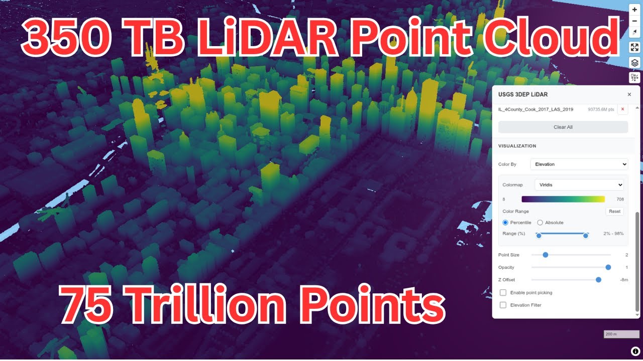
January 18, 2026 – Stream and explore over 75 trillion USGS LiDAR points from AWS and Microsoft Planetary Computer using COPC and Entwine Point Tiles, no downloads required.
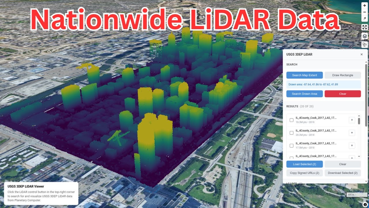
January 14, 2026 – Search, stream, and download USGS COPC point clouds from Microsoft Planetary Computer directly in your browser using the USGS LiDAR Viewer.
January 12, 2026 – Introducing maplibre-gl-lidar, an open-source MapLibre plugin for visualizing large-scale LiDAR point clouds directly in the browser with interactive controls and Jupyter Notebook support.
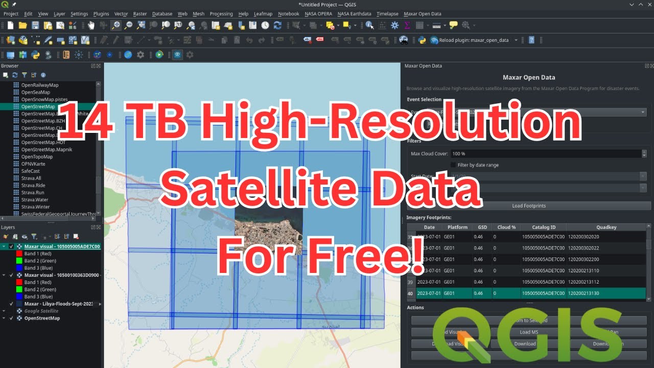
January 10, 2026 – Search, visualize, compare, and download free high-resolution satellite imagery for disaster response using the Maxar Open Data QGIS plugin.
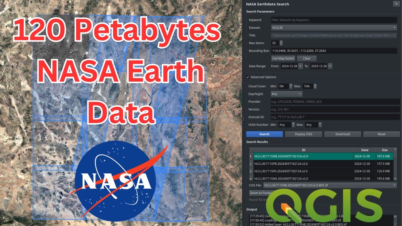
January 6, 2026 – Search, preview, and download satellite imagery and geospatial datasets from NASA’s 120-petabyte archive directly in QGIS using the NASA Earthdata plugin.
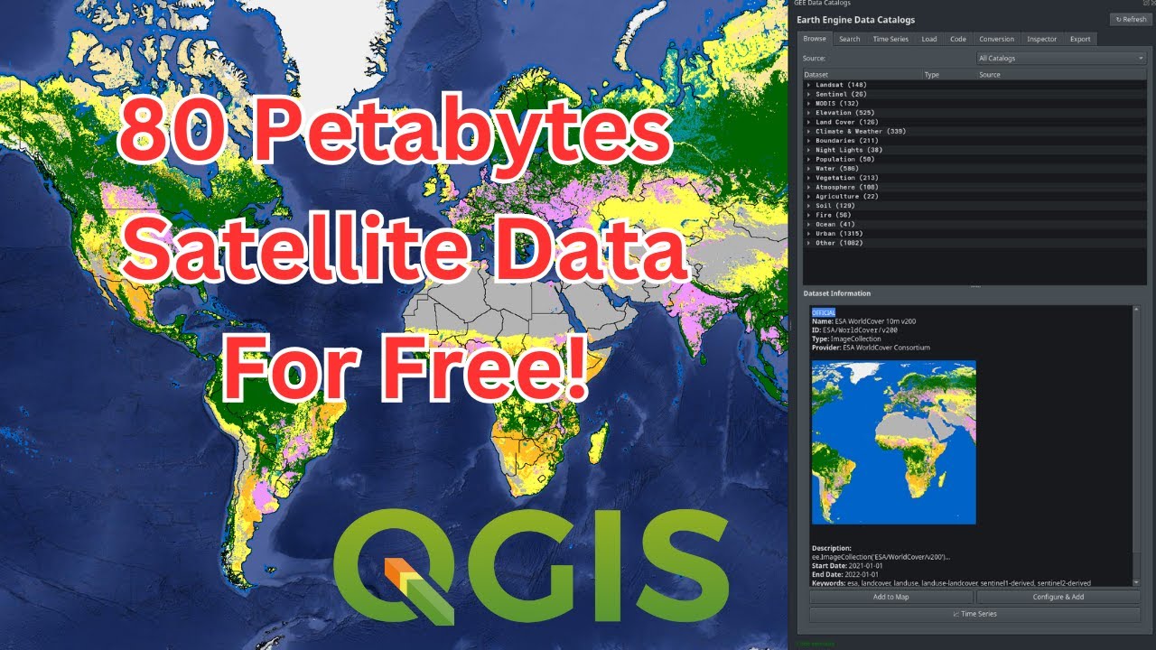
January 3, 2026 – Introducing the GEE Data Catalogs Plugin for QGIS, providing access to over 5,000 datasets from the Earth Engine catalog and Awesome GEE Community Catalog with no coding required.
2025
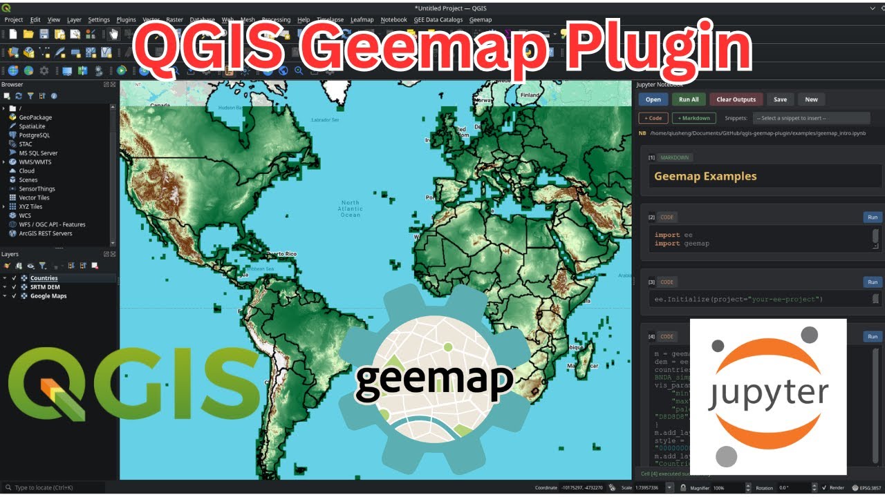
December 31, 2025 – Install and use the Geemap QGIS plugin to run Earth Engine Python code, inspect pixel values, and download datasets inside QGIS with Jupyter Notebook integration.
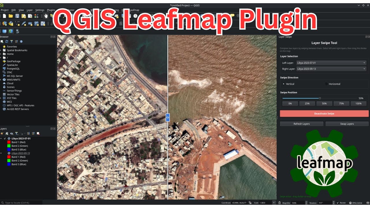
December 30, 2025 – Introducing the LeafMap QGIS plugin with interactive layer transparency controls and a swipe tool for comparing geospatial layers side by side.
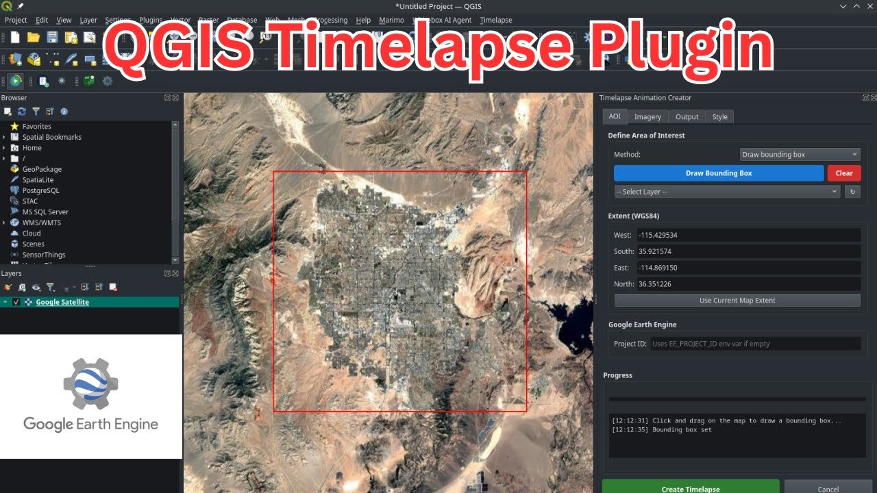
December 27, 2025 – Create animated GIF and MP4 timelapse videos from Landsat, Sentinel, MODIS, GOES, and NAIP imagery using the QGIS Timelapse Plugin powered by Google Earth Engine.